2013_Garibaldi/Brasile
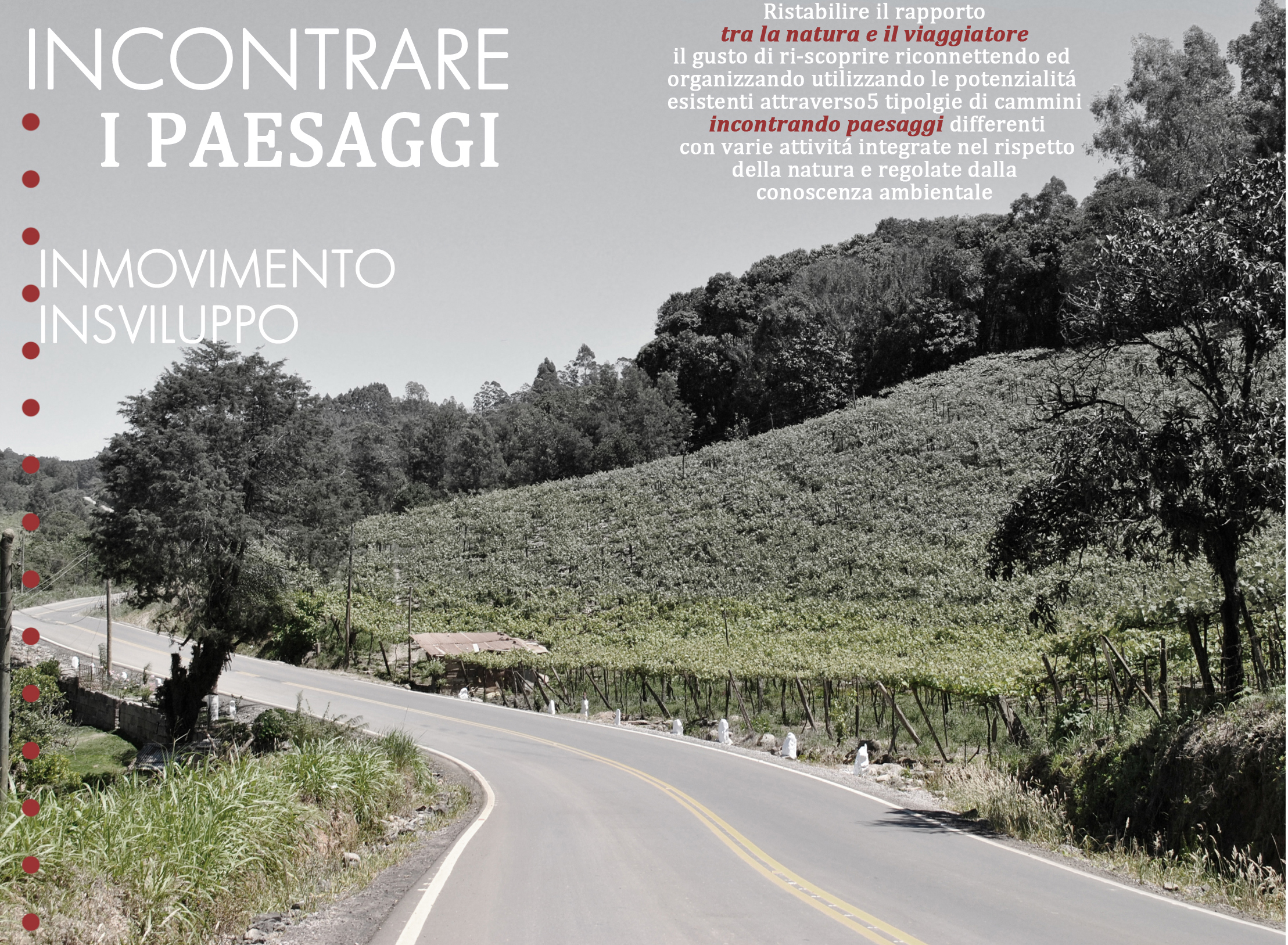
_1a_ Incontrare i Paesaggi
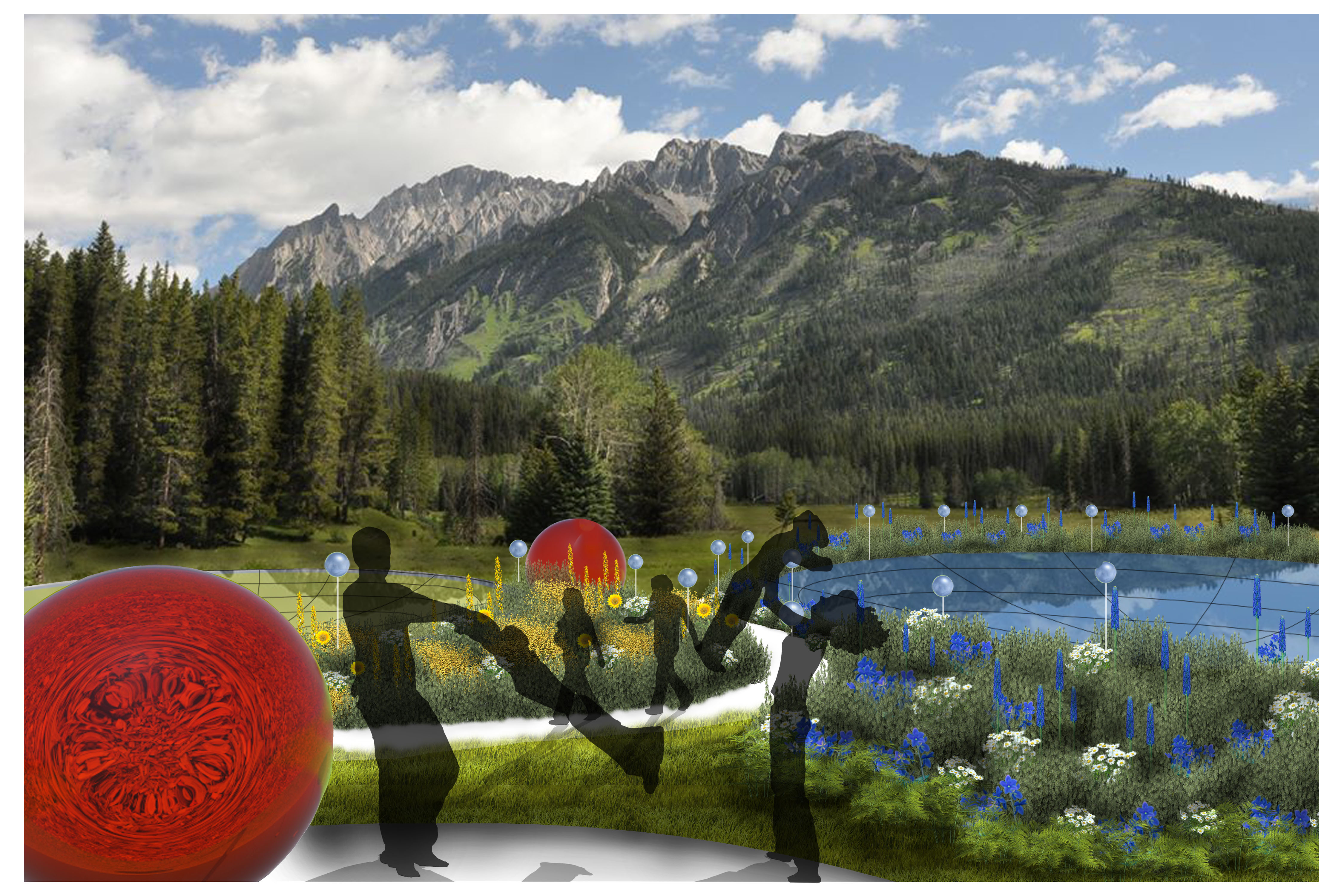
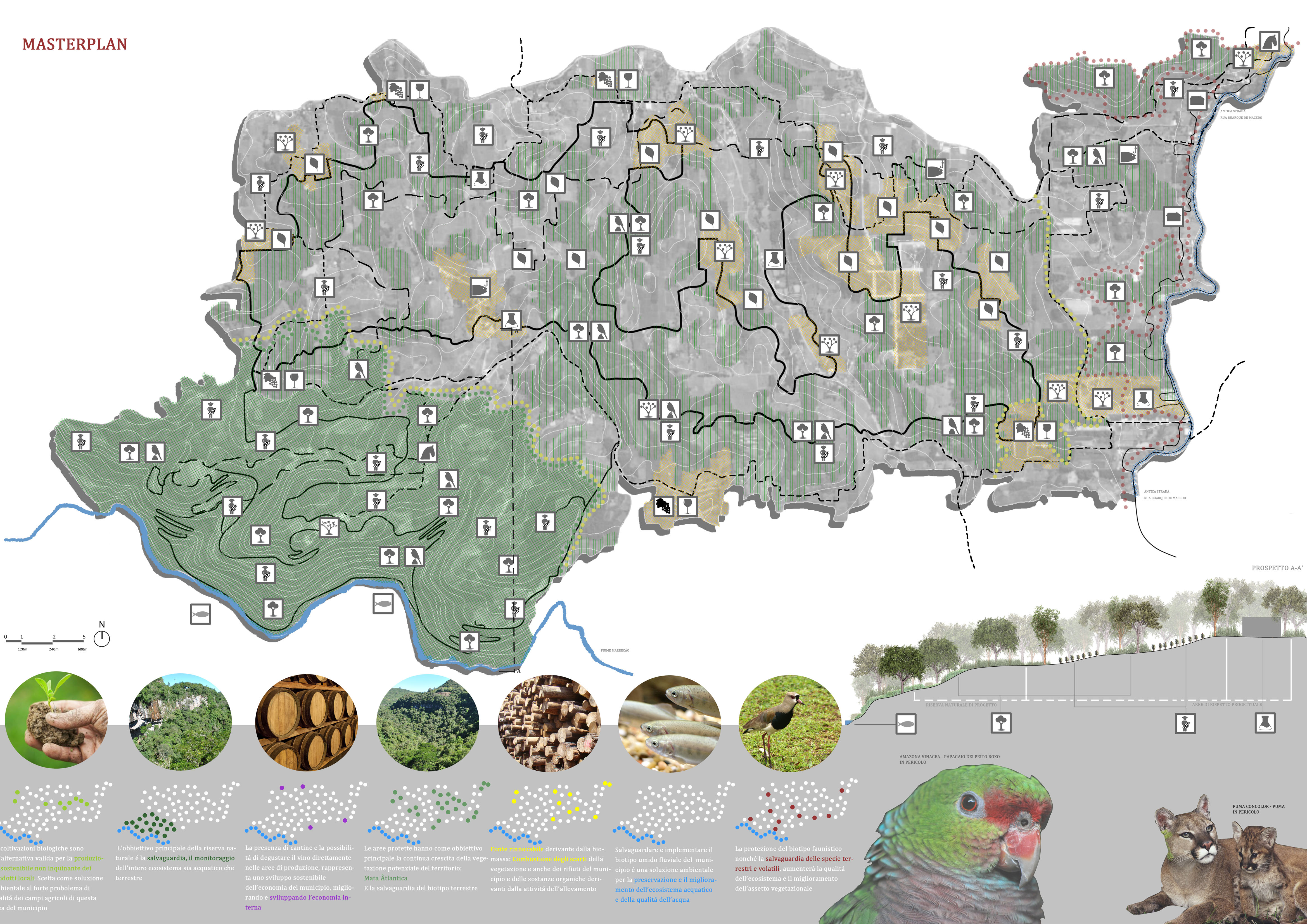
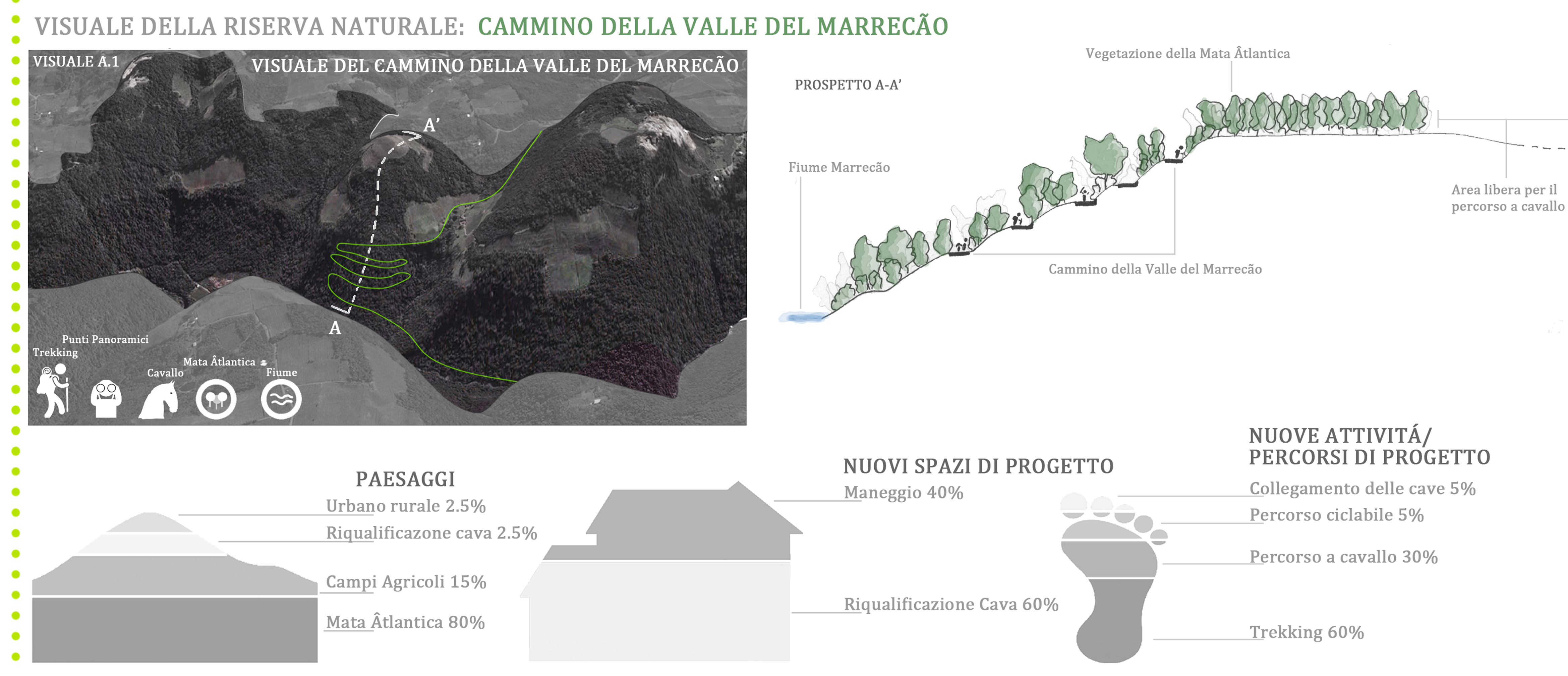
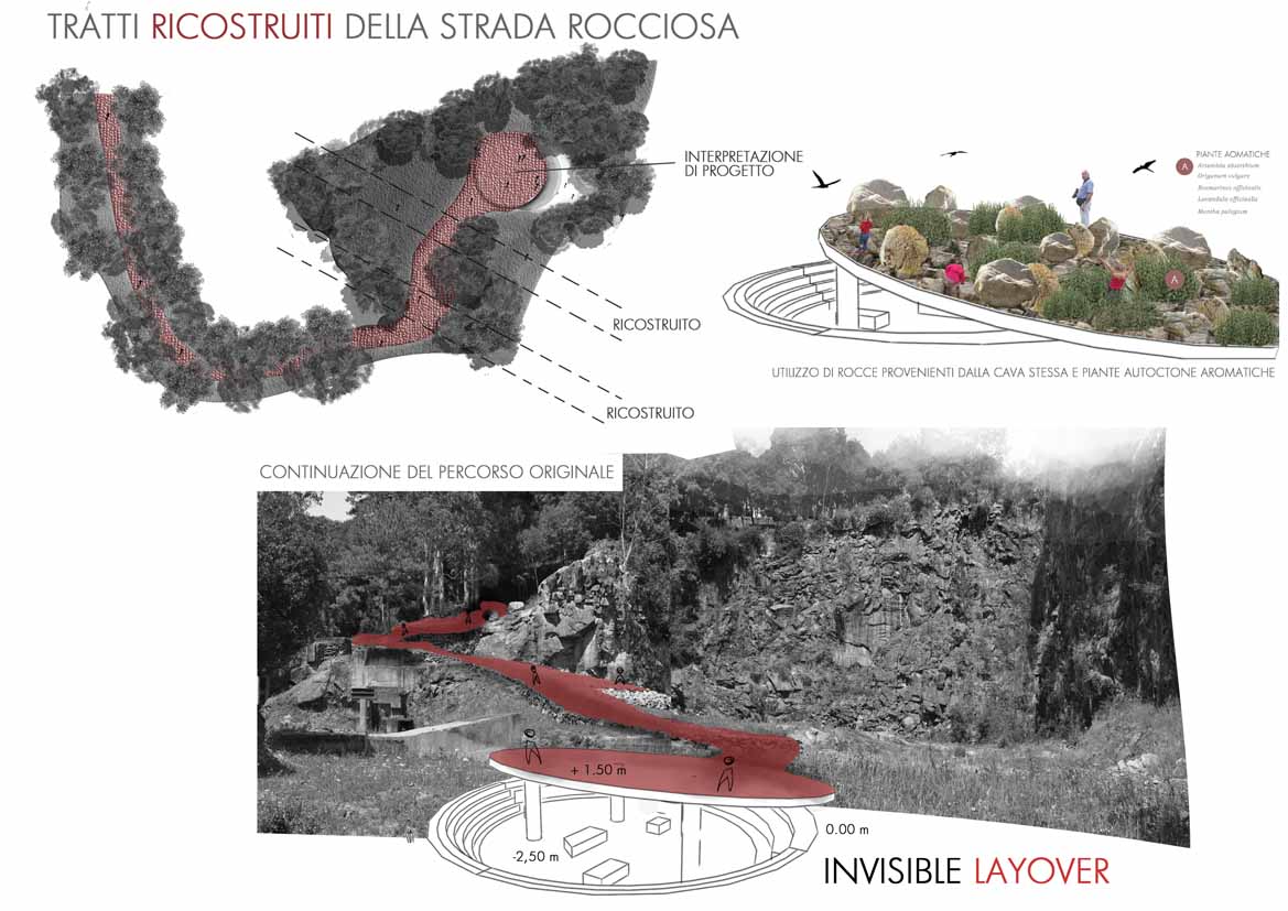
Valle do Marrecão
Tesi di Laurea Magistrale
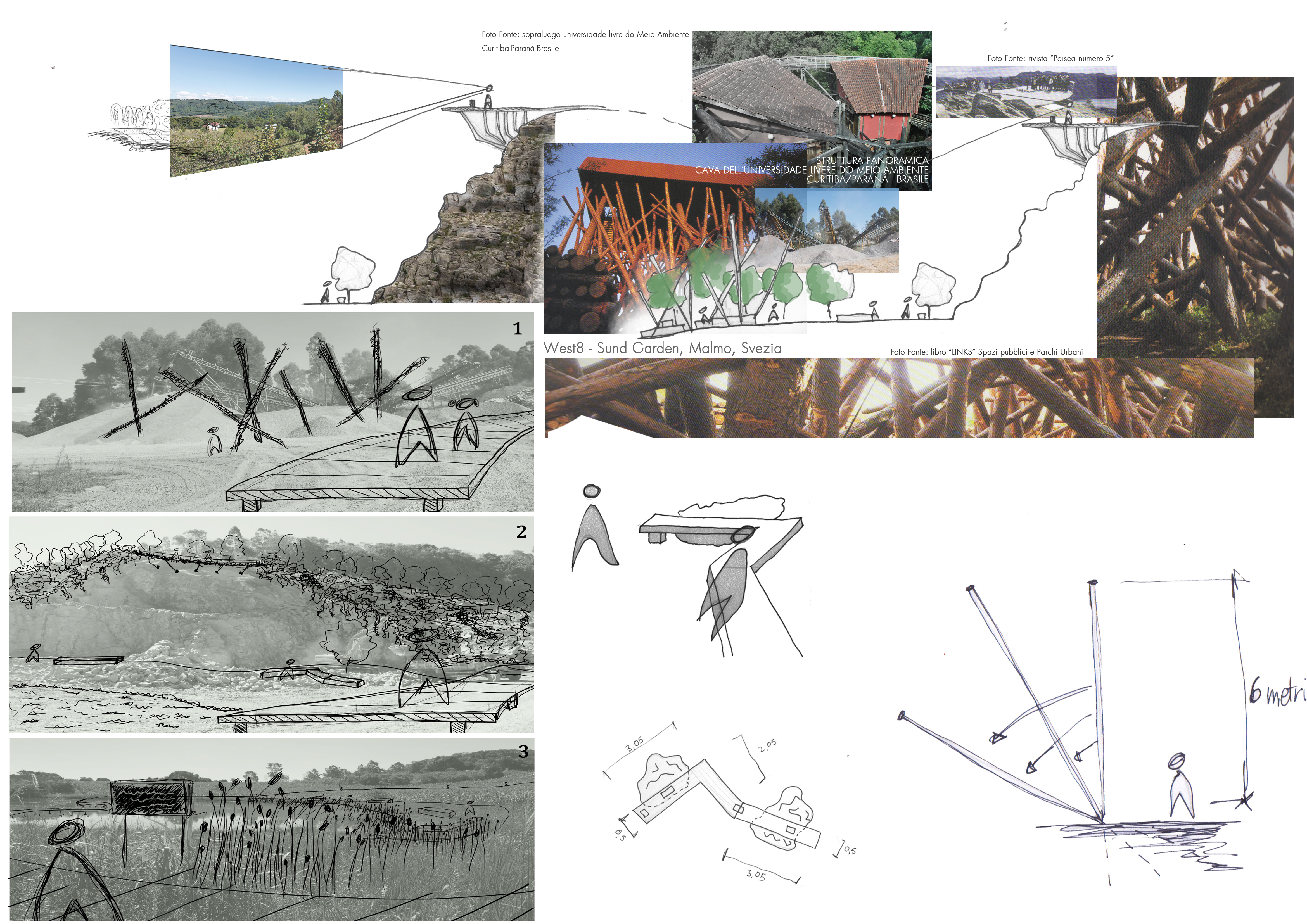
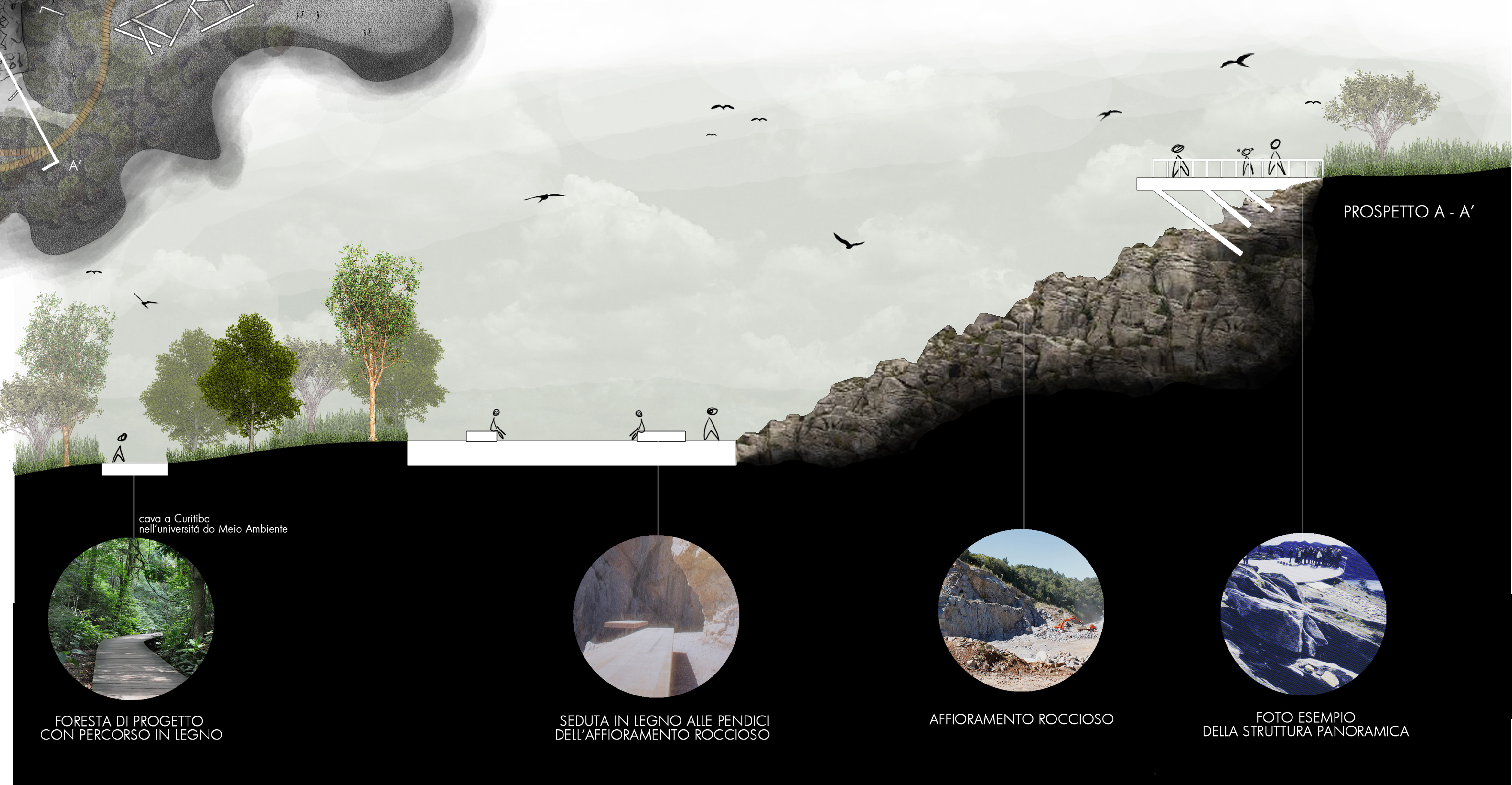
Oggi il territorio è fortemente utilizzato dall'uomo, sin dagli antichi Egizi ai Romani, attualmente le zone di escavazione "cave" di minerali e rocce sono molto diffuse in tutto il territorio mondiale, rappresentando una criticità e nello stesso tempo una potenzialità del territorio. Per questo motivo, dopo un'approfondito studio di analisi fisico/naturalistica, antropica e sociale/economica in scala territoriale ho deciso di prendere come oggetto studio la riqualificazione della cava nel municipio di Garibaldi nella valle del Marrecão utilizzando tecniche di semina e consolidamento, ricollegando le polarità dell'area e rinterpretando i segni del suo passato.
_1a_ Meet the Landscapes
Valley of Marrecão
Master Thesis Project
Today, the territory is heavily used by man, from the time of the ancient Egyptians to the Romans. Presently, the areas of the excavation “cave” of minerals and rocks are widespread throughout the world, representing a critical point and at the same time a potentiality of the said area. For this reason, after a thorough analytic study of the physico/natural, human and social/economic aspects of the area in a territorial scale, I decided to take as the research subject study the redevelopment of the caves around the town of Garibaldi, in the valley of Marrecao, using techniques of sowing and consolidation, reconnecting the polarities of the area, and interpreting the signs of its past.


progetto individuale: Tesi di laurea magistrale in Architettura del Paesaggio (Brasile)
relatore: Prof. Elio Trusiani
correlatori: Prof. Décio Rigatti (Porto Alegre/Universidade Federal do Rio Grande do Sul)
Prof. Romeo Di Pietro (Roma/La Sapienza)
2013_Garibaldi/Brasile
_1b_ Incontrare i Paesaggi
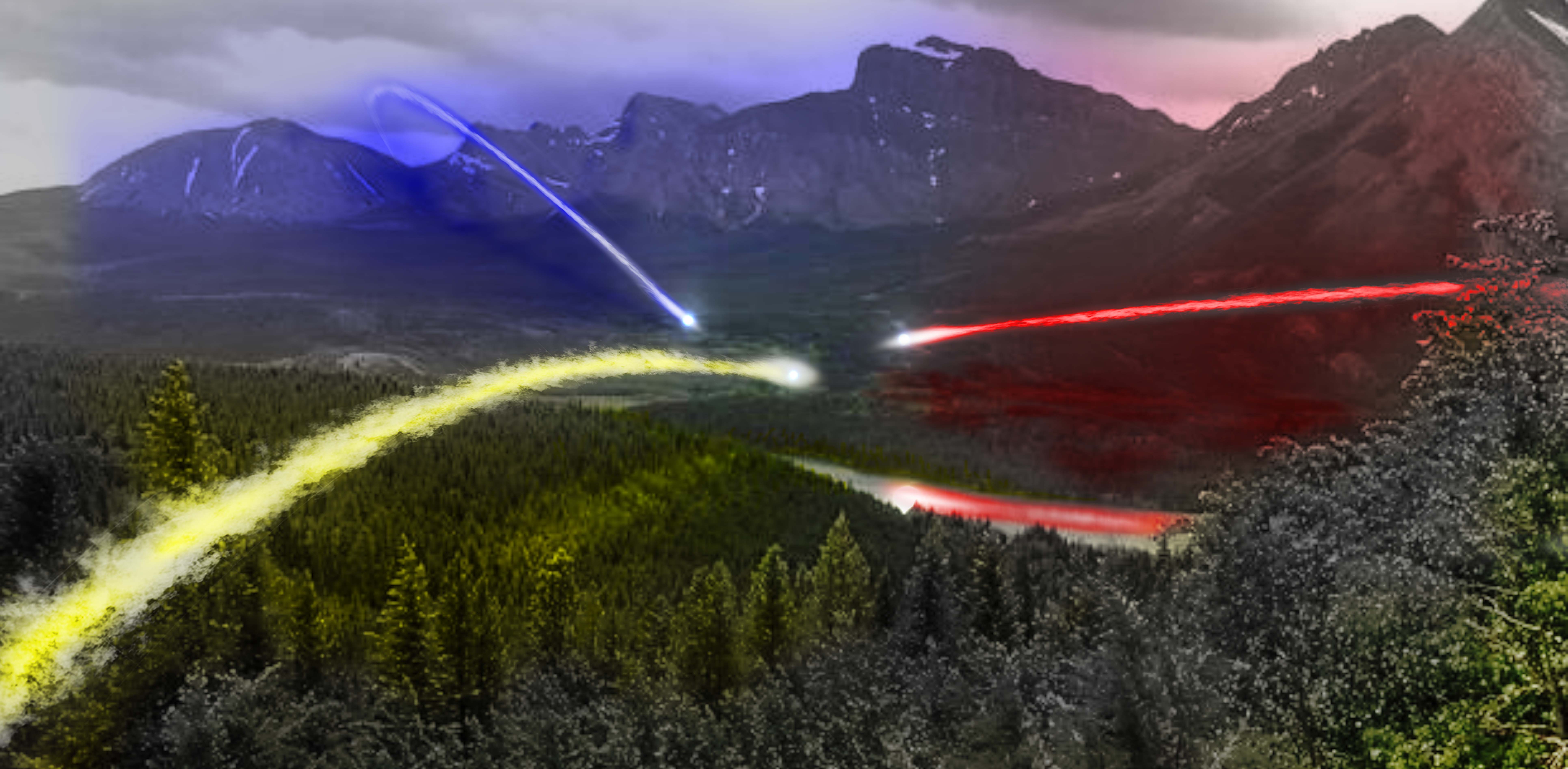
Invisible LAYOVER
Tesi di Laurea Magistrale
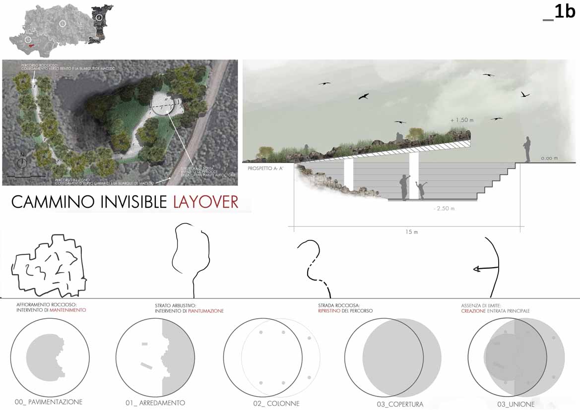
Rispetto alla precedente cava, questa si localizza come nuova polarità sull'asse storico della strada Rua Buarque de Macedo che collega alle due estremità i municipi di Garibaldi e Bento Gonçalves. Nel progetto assumerà una funzione di sosta lungo la strada antica, un momento di riposo e relax invisibile, ricostruendo un vecchio percorso in roccia collegata a una struttura /piazza sotto il livello del terreno coperta da piante aromatiche e dallo stesso materiale roccioso della strada.
_1b_ Meet the Landscapes
Invisible LAYOVER
Master Thesis Project
Compared to the previous cave, this is localized as a new point into which revolves the old street Rua Buarque de Macedo, which, in turn, connects the two towns of Garibaldi and Bento Gonçalves. The project will assume the function of a rest area along the ancient road, a moment of rest and relaxation, made possible by rebuilding an old path in the rock attached to a structure/square below the level of the land covered by the same rocky material and aromatic plants.
progetto individuale: Tesi di laurea magistrale in Architettura del Paesaggio (Brasile)
relatore: Prof. Elio Trusiani
correlatori: Prof. Décio Rigatti (Porto Alegre/Universidade Federal do Rio Grande do Sul)
Prof. Romeo Di Pietro (Roma/La Sapienza)
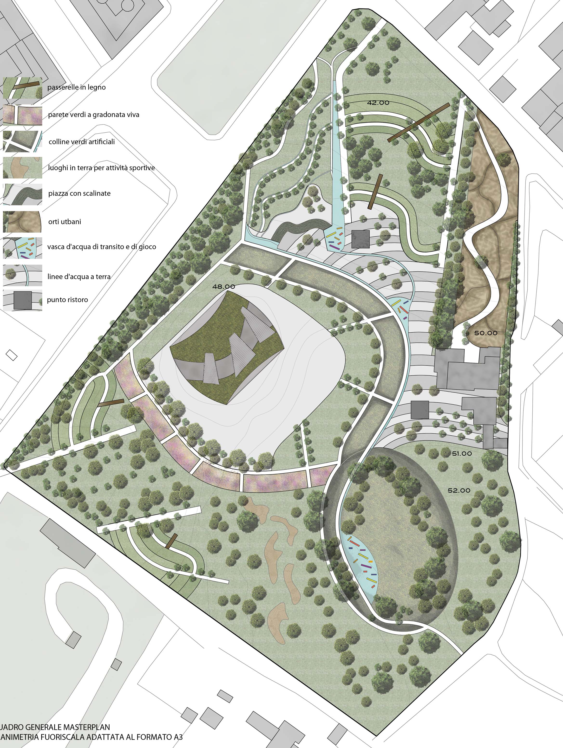
2011_Malagrotta/Roma/Italia
_2_ Parco AgroEnergetico: Riconnessione "Friches" Ex-Cava
Laboratorio di Progettazione Ambientale
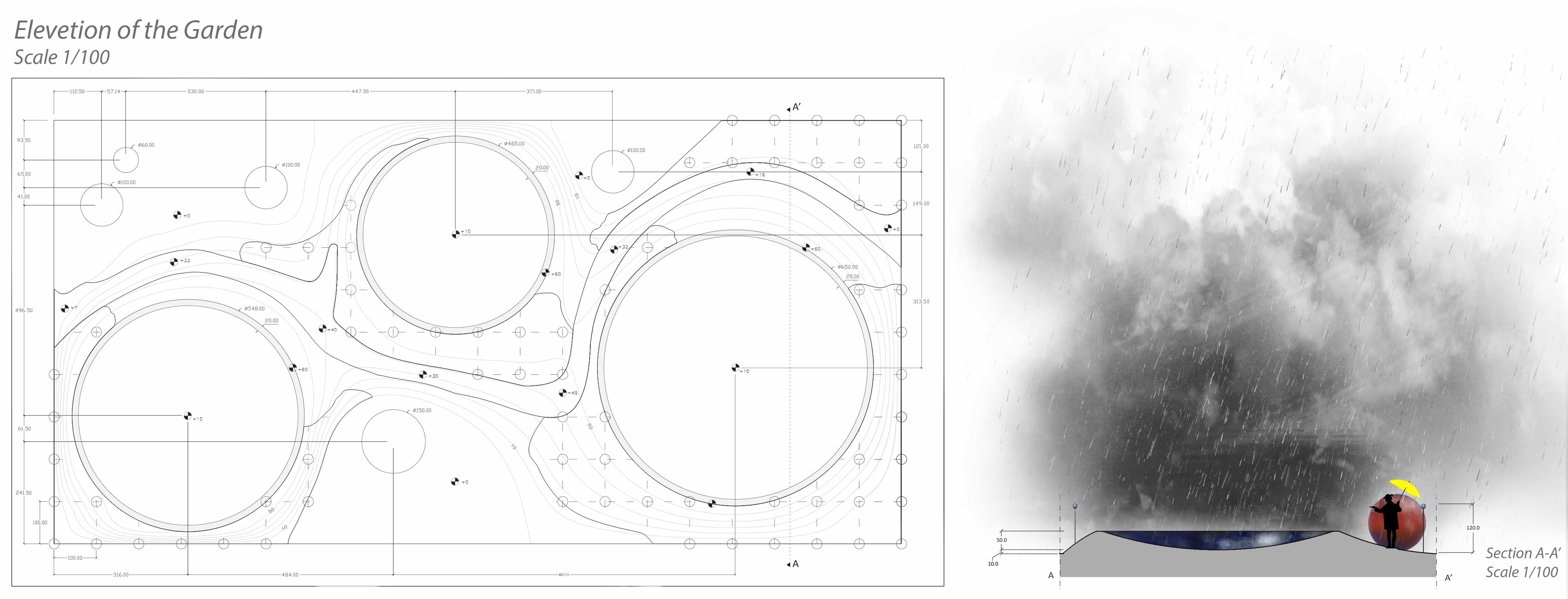
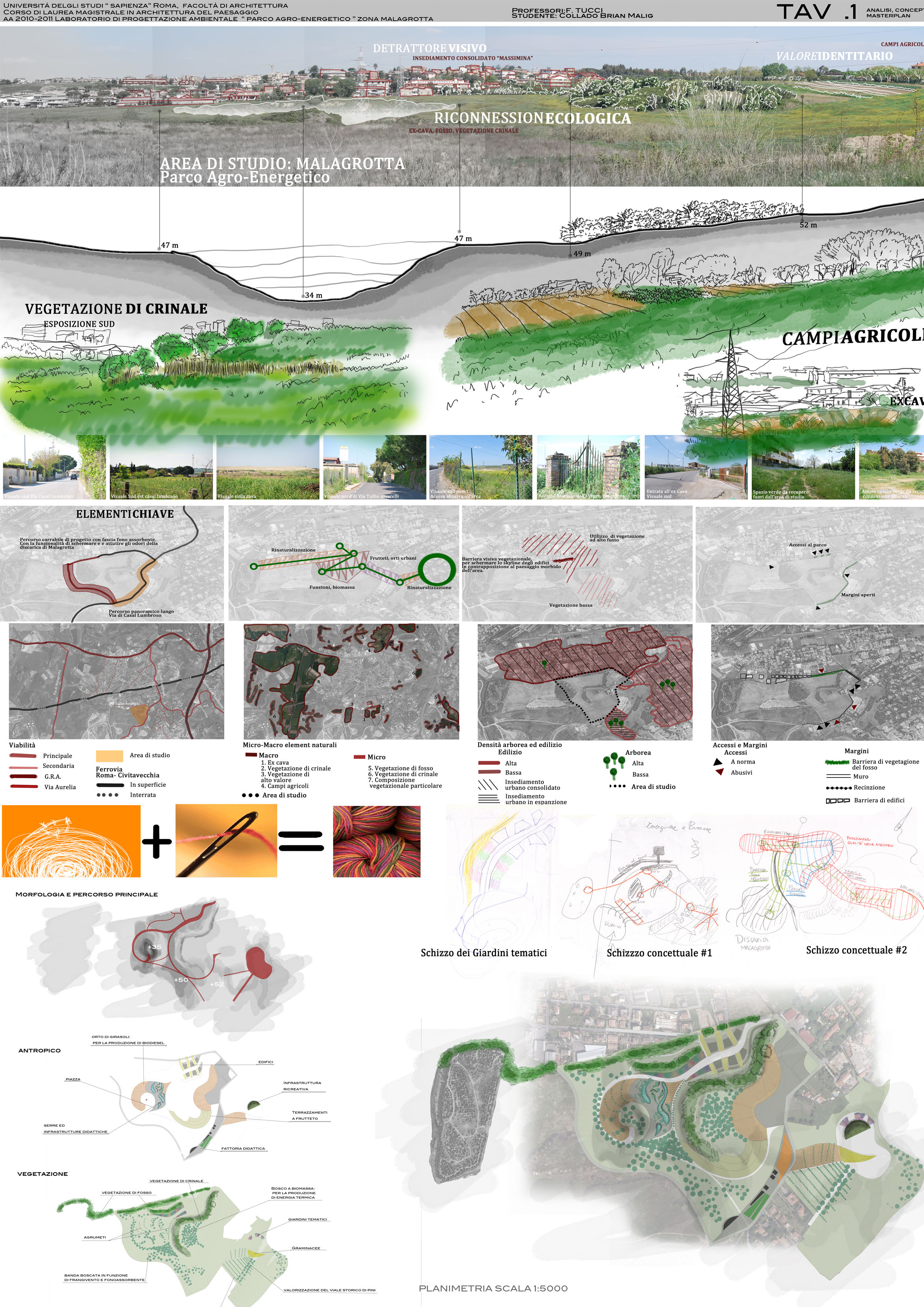
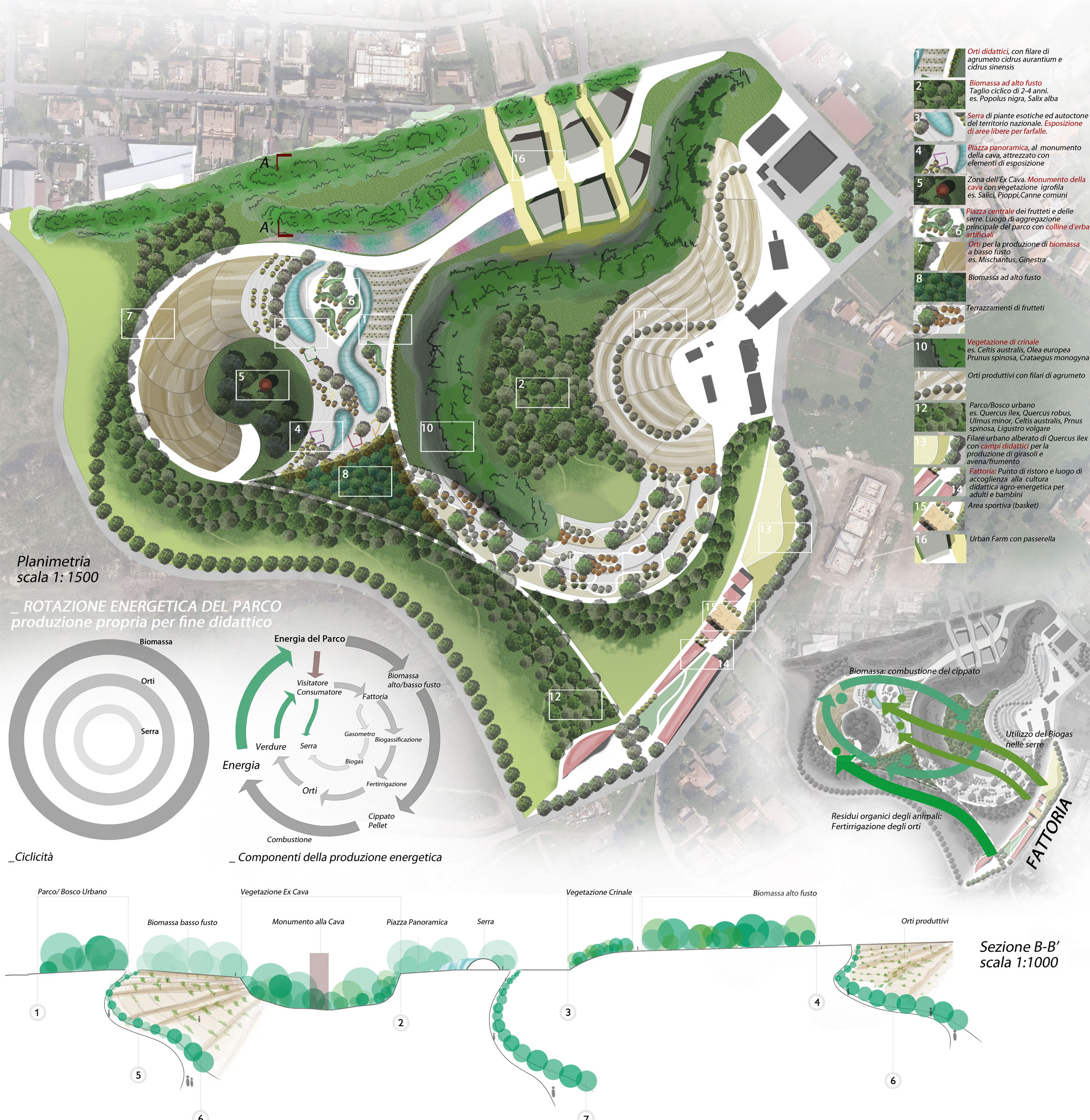
L'area di studio, lontano dal grande elemento naturale fiume Tevere, si trova al di fuori del GRA. Come lo definerebbe Gilles Clèment è una " FRICHES". La friches è un'opportunità della natura di rimpadronirsi di una zona precedentemente occupata dall'uomo, con le sue azioni fortemente impattanti sull'ambiente lasciando il territorio abbandonato, incolto e senza alcuna funzione. La "friches" è posta al centro tra l'ex cava e l'insediamento urbano in evoluzione Massimina, rappresenterà l'elemento di connessione, di cerniera e al tempo stesso una barriera verde al forte espansionismo agricolo insediativo.
_2_ AgroEnergy Park: Reconnection "Friches" Ex-cave
Laboratory of Ambiental Project
The study area, away from the immense and natural element of the Tiber River, is located outside the GRA (Grande Raccordo Anulare, otherwise known as the Junction that encircles Rome). As described by Gilles Clément it is a “FRICHES.” The “friches” is an opportunity given by nature to reclaim an area previously occupied by man, and by means of the impact of man’s activities on the environment the territory is left abandoned, uncultivated, and practically useless. This “friches” is then placed at the center between the cave and the urban settlement in evolution Massimina, which will represent the connecting element, the turning point, the green barrier to the rapidly growing agricultural settlement.
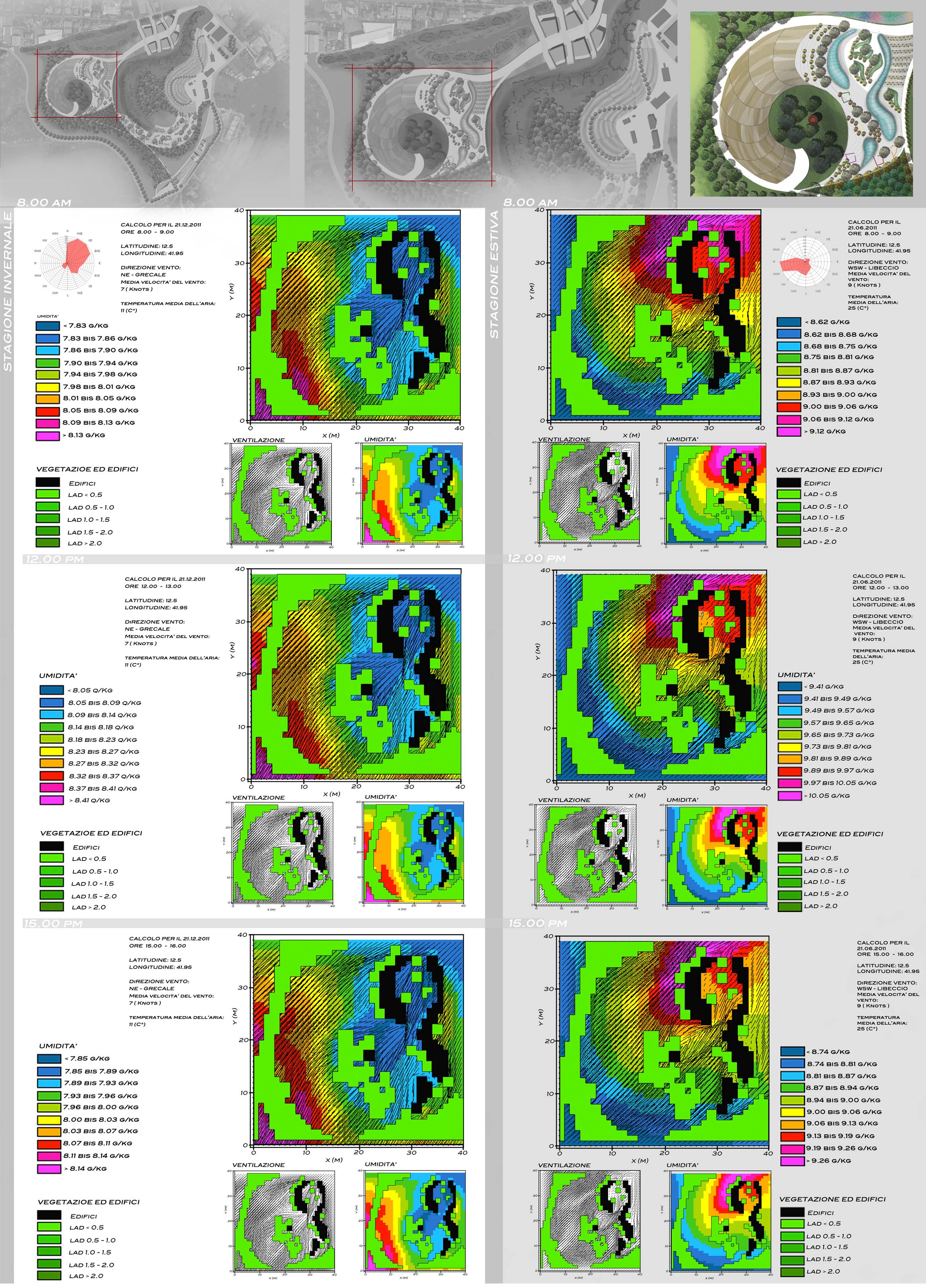
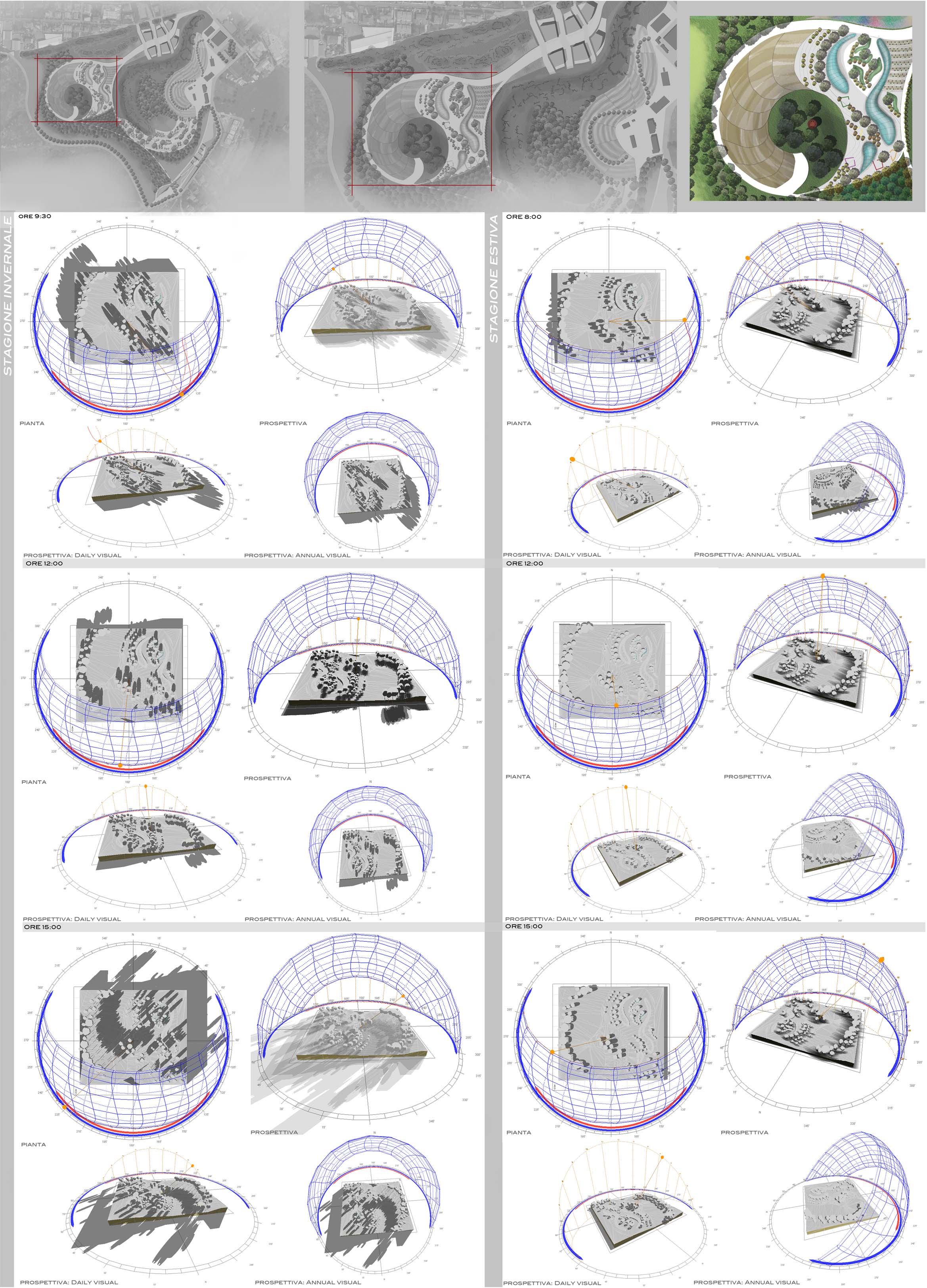
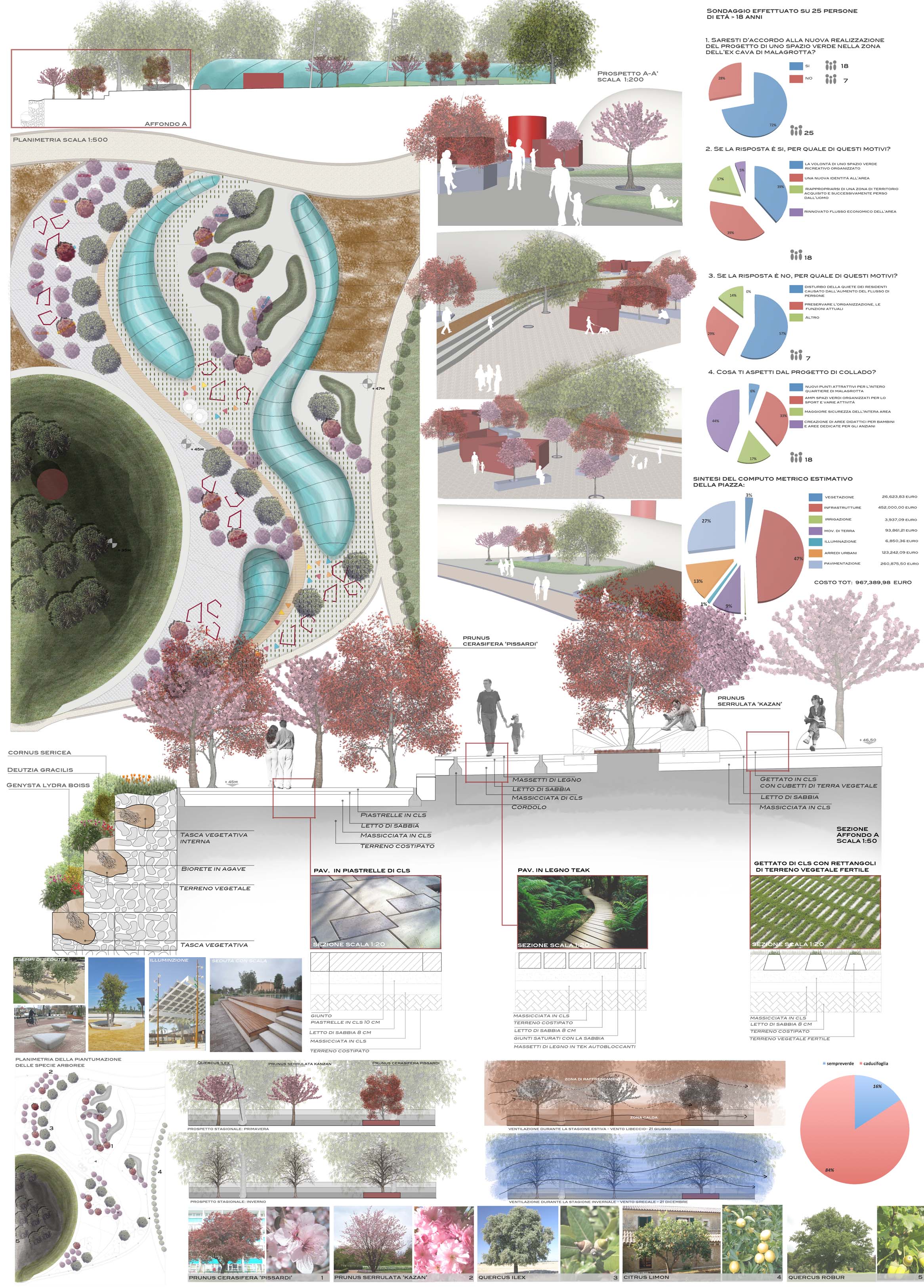
progetto individuale: corso di Progettazione Ambientale - Prof. Fabrizio Tucci
2011_Parco di Tor Pignattara/Roma/Italia
_3_ Paesaggio Multicolore: tra luce e ombra
Laboratorio di Architettura del Paesaggio
Progettare la luce vuol dire creare immaginazione, stabilire un rapporto tra uomo e ambiente attraverso la definizione di scene fatte di luce e ombre. Luce e ombra creano paesaggio, tutto è paesaggio, ma non è sufficiente mettere insieme un gruppo di elementi animati e non. Per fare un paesaggio: ciò che conta sono le immagini, gli stati d'animo, le interpretazioni dell'osservatore rispetto alle cose percepite. Il gioco della luce e dell'ombra possono creare sensazioni ed emozioni all'osservatore, creando un collegamento con lo stato interiore dell'animo e il paesaggio esterno.
La luce nasconde immense potenzialità per cambiare progressivamente i paesaggi che ci circondano in paesaggi notturni.
Laboratory of Landscape Architecture
To design with light is to create imagination, to establish a relationship between man and environment through the interplay of scenes made of light and shadows. Light and shadow create landscape. Everyting is assumed to be landscape, but putting together a series of animated and non animated elements is not enough. To make a landscape: what matters are the images, moods, interpretations of the observer with respect to the objects being perceived. The play of light and shadow can transmit feeling and emotion to the viewer, creating a connection between the inner state of the soul and the external landscape.
The light hides an immense potential to change progressively the landscapes that surround us in night landscapes.
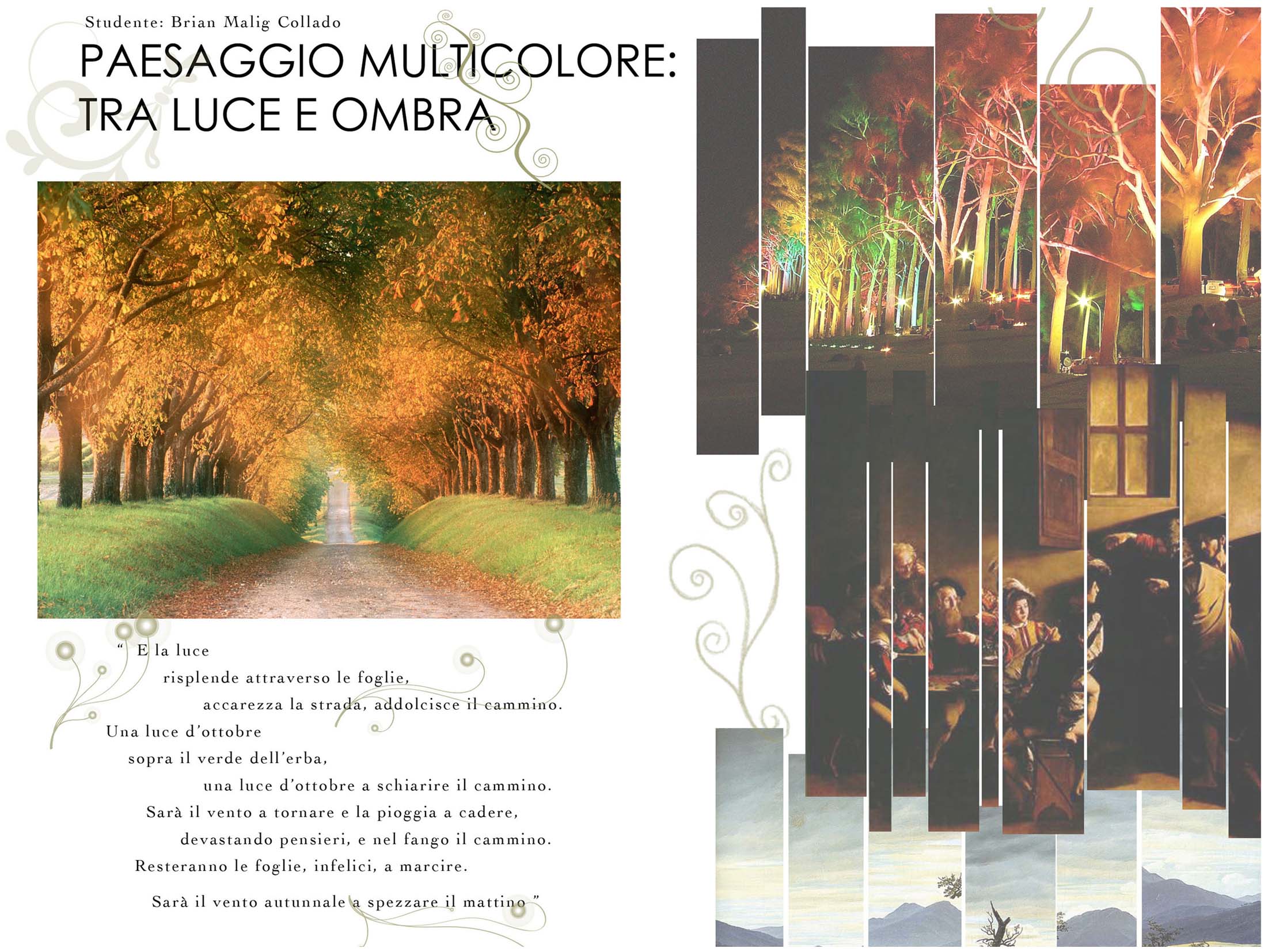
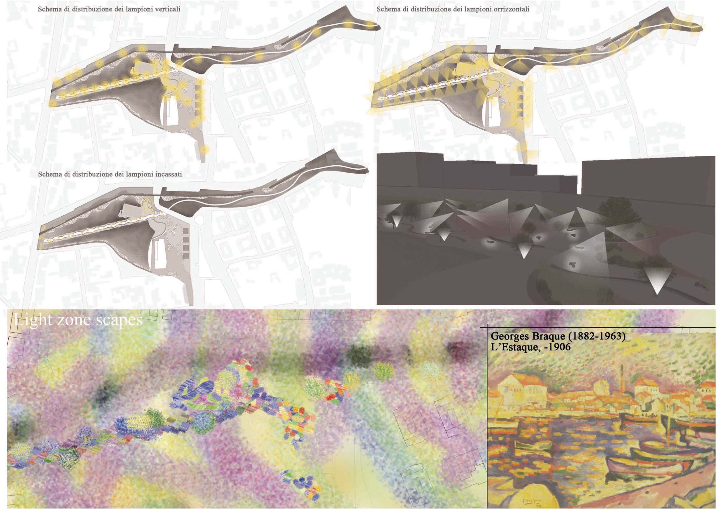
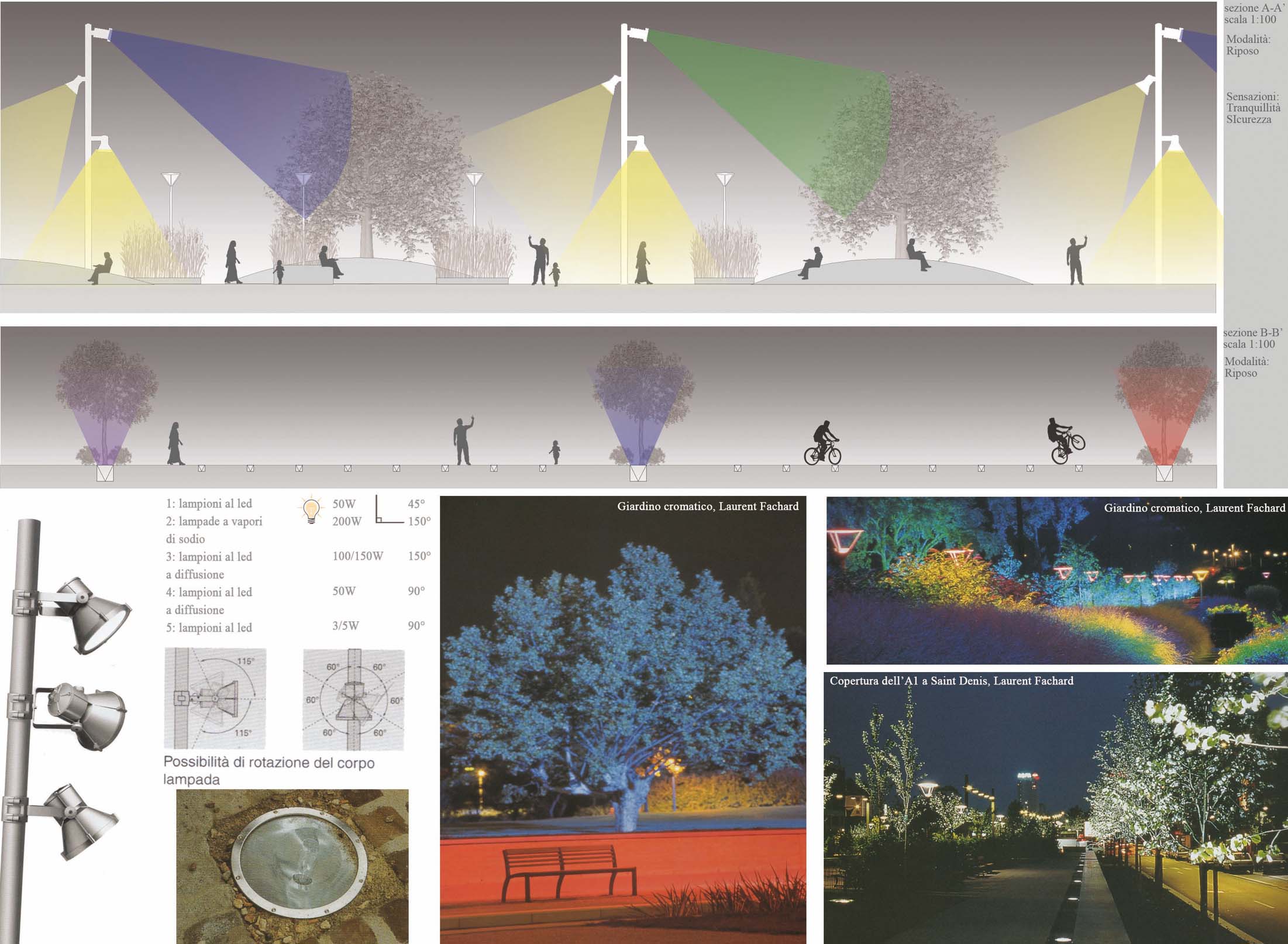
progetto individuale: Corso di Architettura del Paesaggio - Prof. Fabio Di Carlo
2010_Arco di Travertino/Roma/Italia
_4_ Laboratorio di infrastrutture e paesaggio
Arco di travertino è una delle ultime zone che confinano tra il centro/periferia di Roma, un nodo di scambio tra autobus e metro per i residenti romani molto importante. Un'area molto movimentata soprattutto di giorno e ultimamente rafforzata dai lavori della nuova stazione di autobus Arco di travertino. L'area presa in studio si posiziona tra la nuova stazione di autobus e quella della metro. Un'area abbandonata, senza funzione e identità, soggetta a inquinamento e costruzione intensiva di residenze abusive.
_4_ Laboratory of infrastructures and landscape
Arco di Travertino is one of the last areas which border between the center/periphery of Rome, an important interchange between bus and metro residents. The zone is a very busy area, given the number of commuters, especially during the day, and is recently reinforced by the current construction of the new bus station Arco di Travertino. The area taken in study is positioned between the new bus station and the metro. An abandoned zone, without identity and function, subject to pollution and intensive construction of illegal dwellings.
progetto individuale: Laboratorio di infrastrutture e paesaggio - Proff.ri: Enrico Genovesi,
Alessandro Pagliaroli
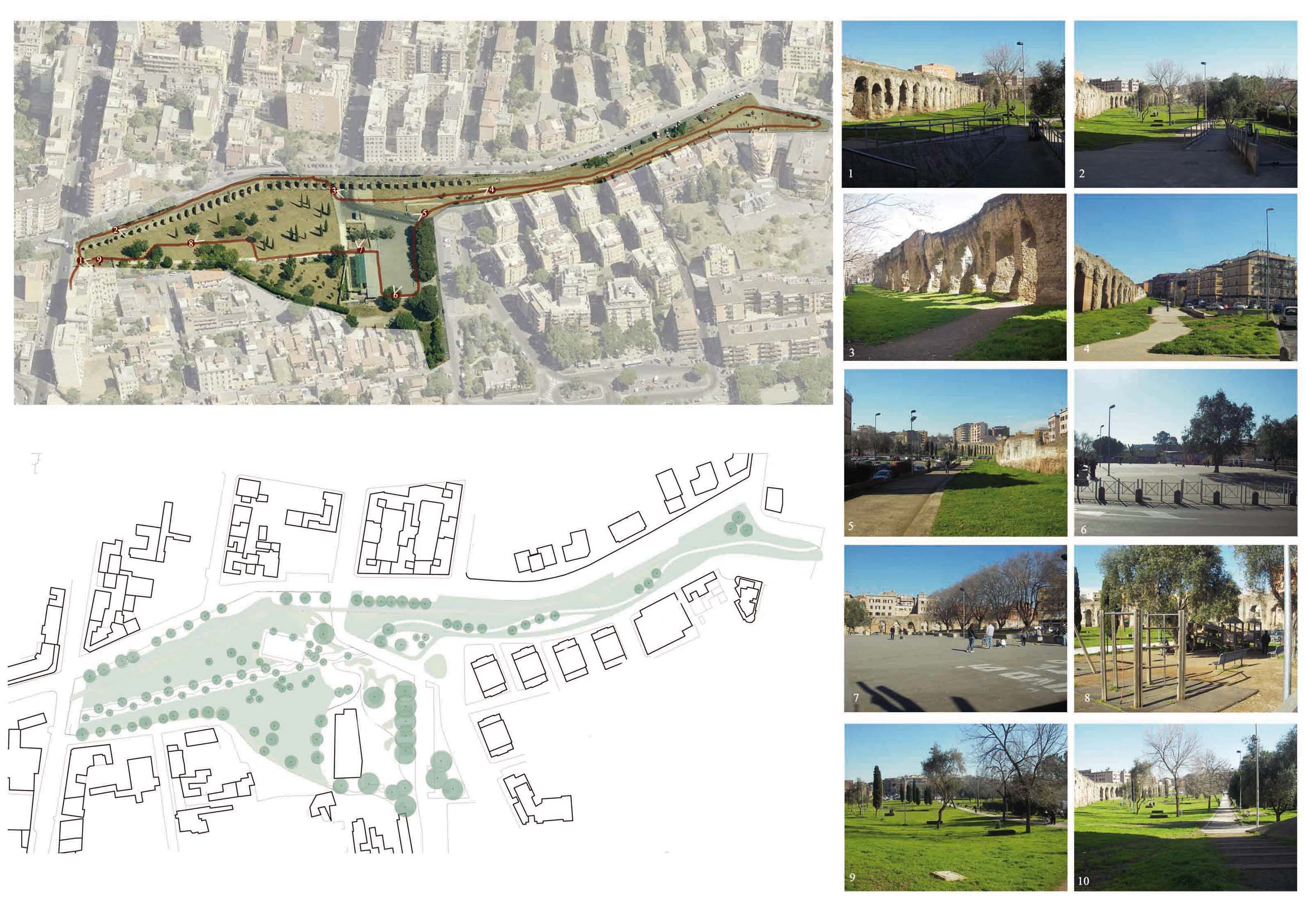
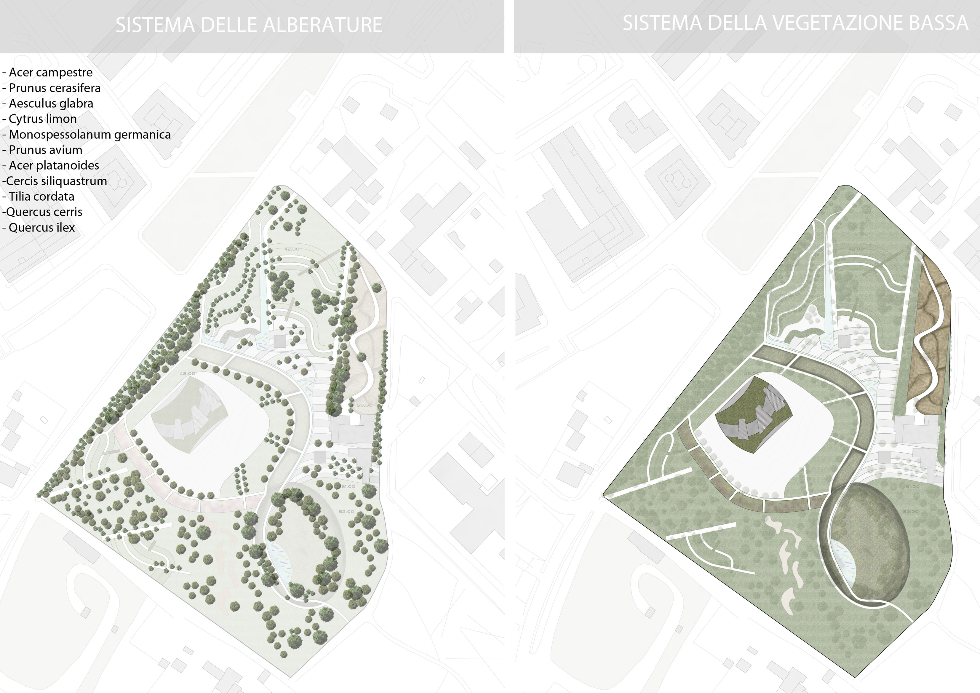
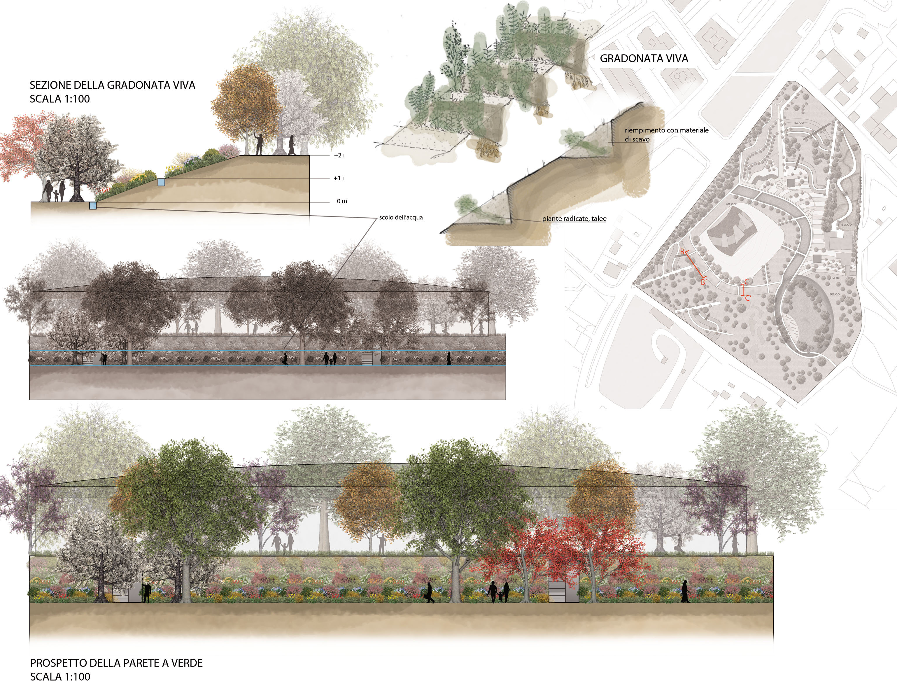
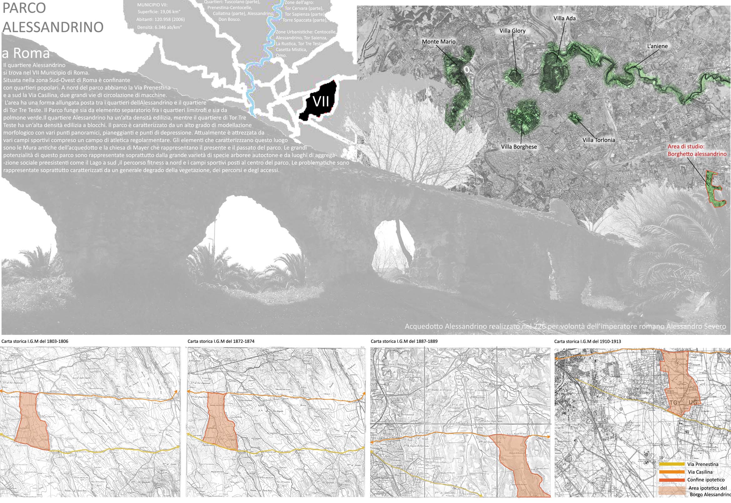
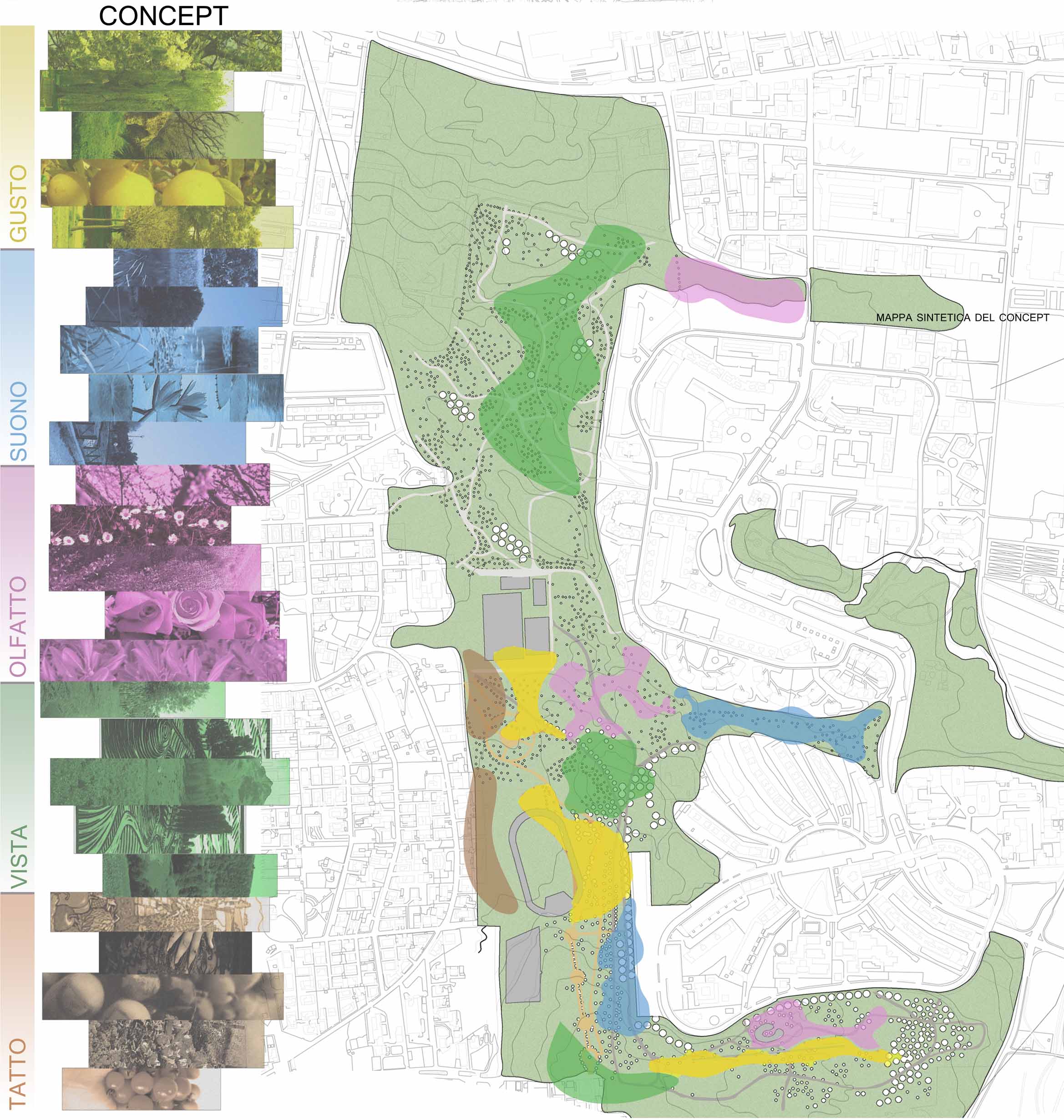
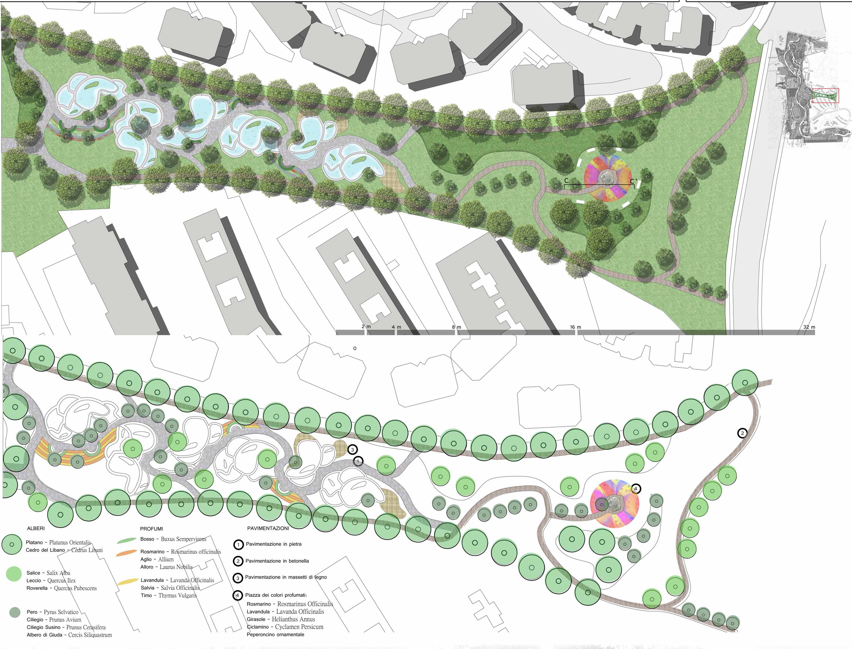
2009_ Parco Alessandrino/Roma/Italia
_5_ Tesi di Laurea Triennale: Riqualificazione del Parco Alessandrino
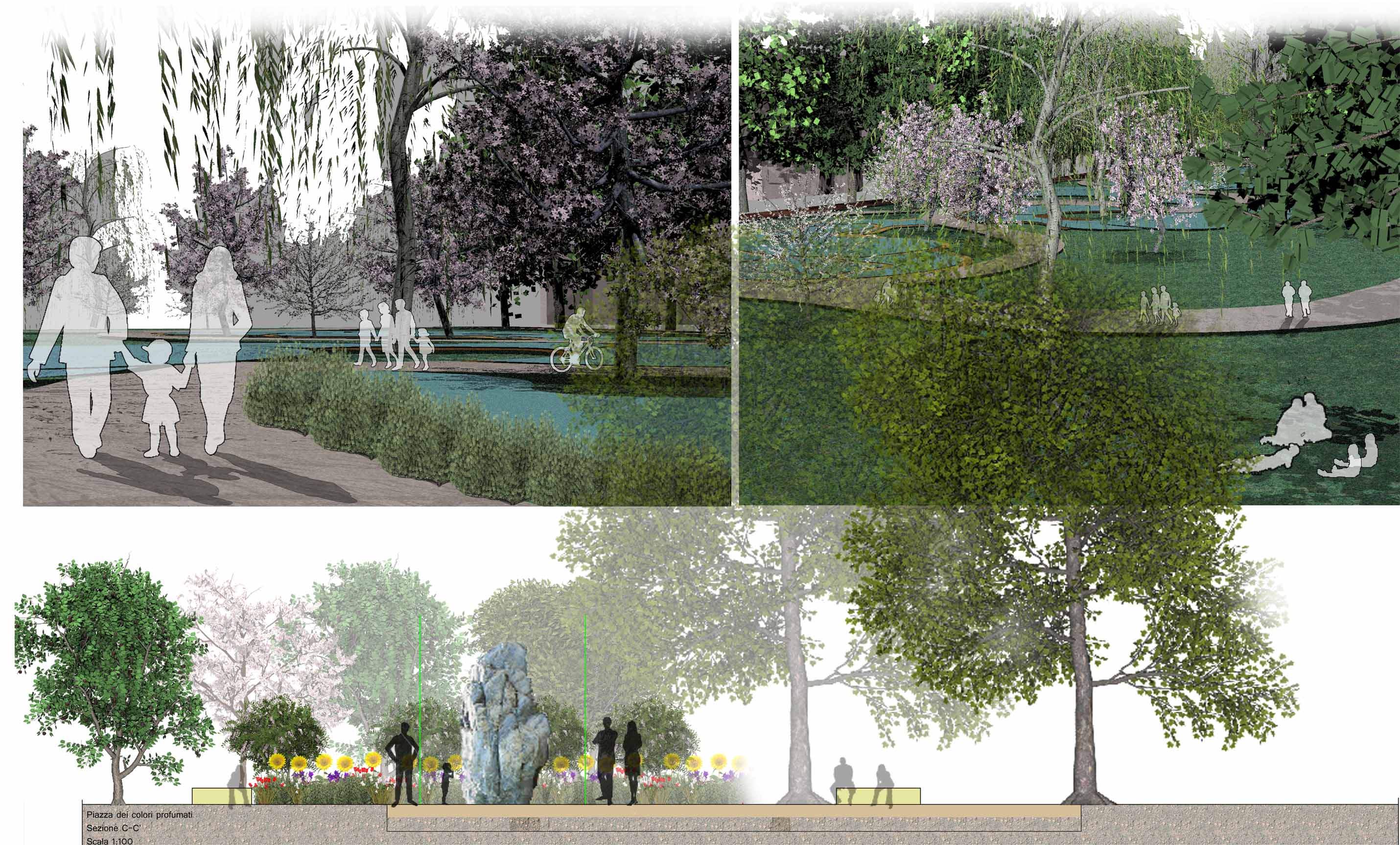
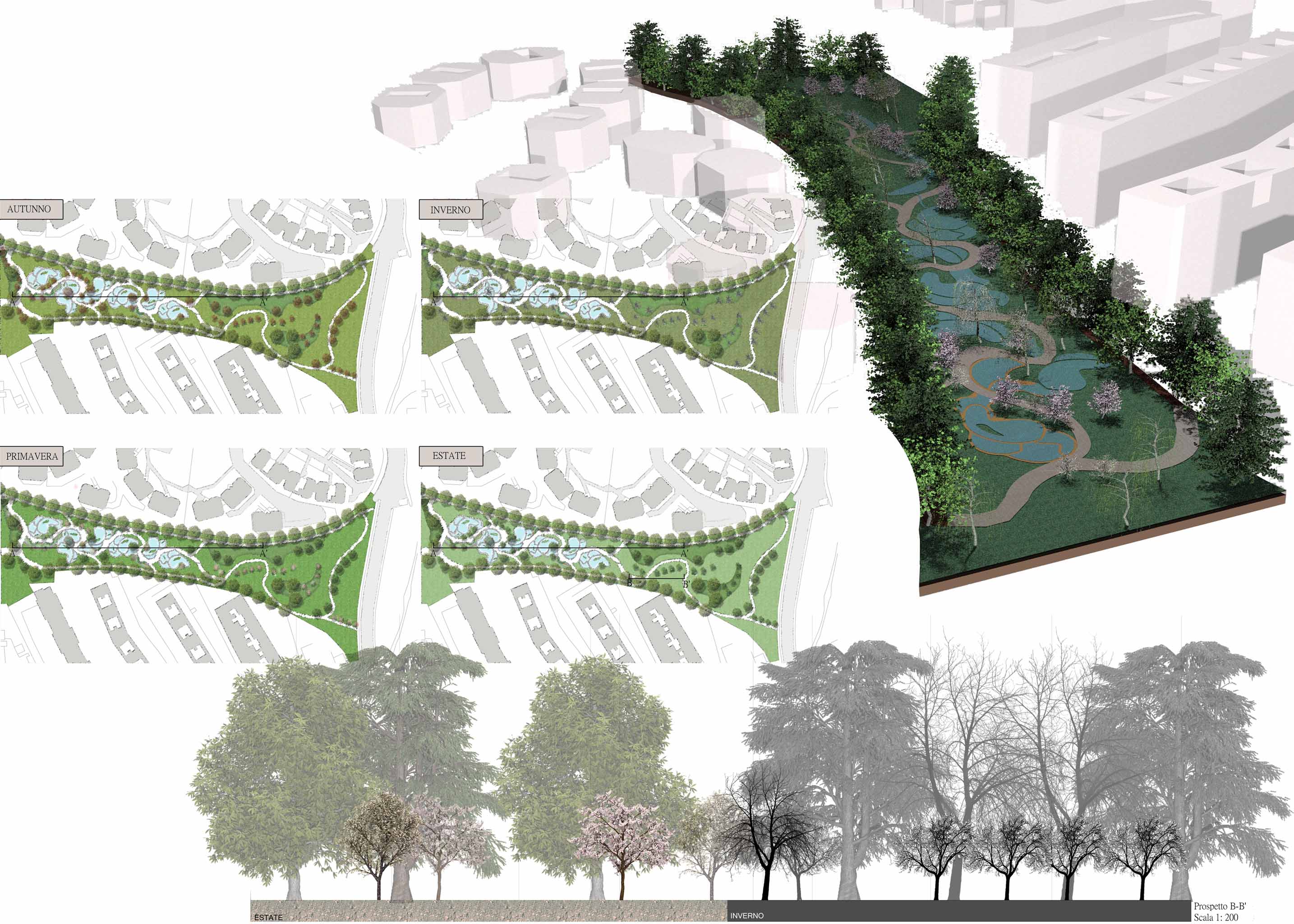
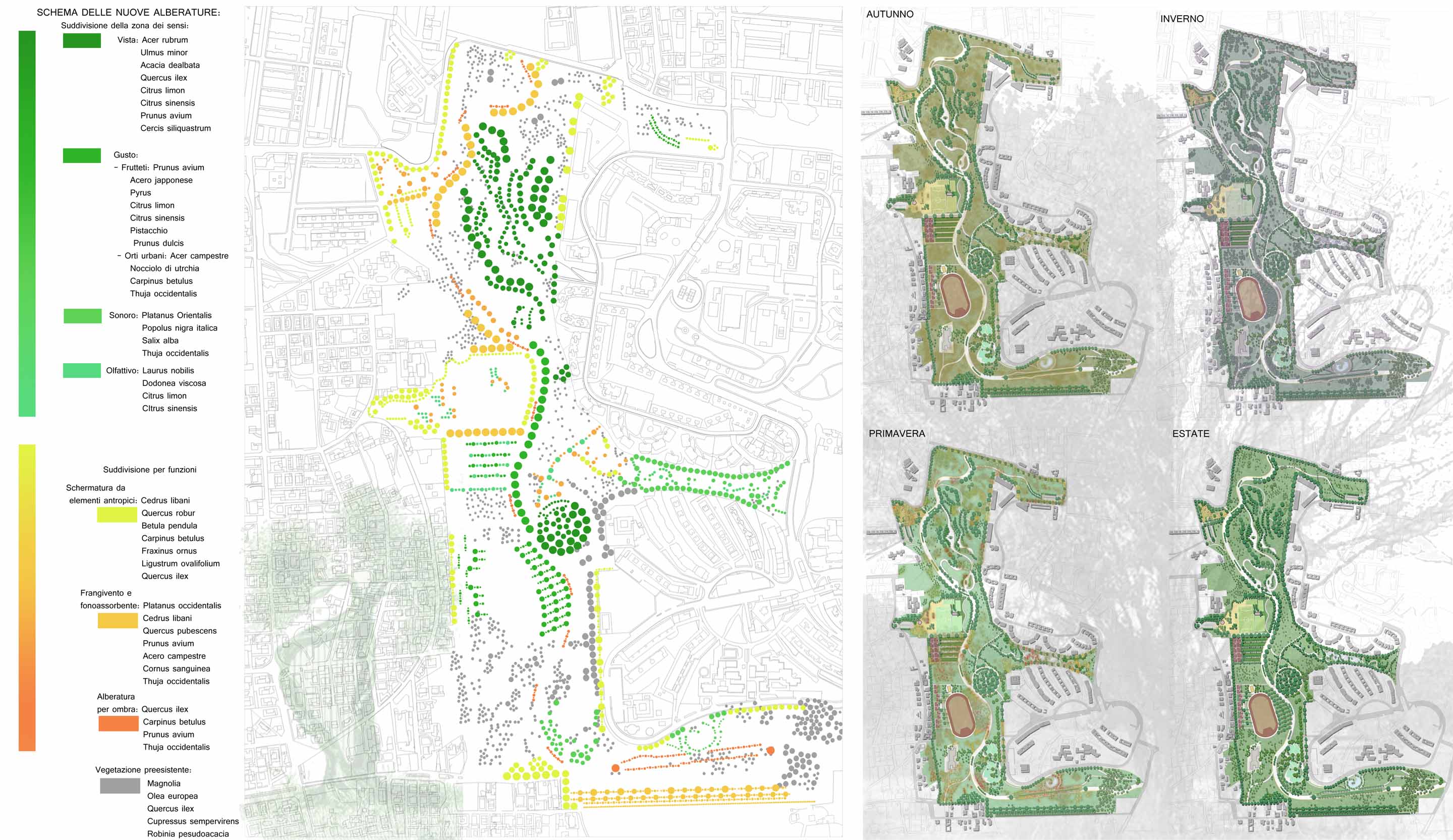
Parco dei cinque sensi
Il quartiere Alessandrino si trova nel VII Municipio di Roma. Ha una forma allungata e funge sia da elemento separatorio fra i quartieri limitrofi e sia da polomone verde. Ha un alta densità edilizia con un elevato grado di modellazione morfologico con vari punti panoramici e punti di depressione. Attualmente è attrezzata con campi sportivi di atletica regolamentari. Gli elementi caratterizzanti sono le Mure antiche dell'Acquedotto Romano e la chiesa di Mayer che rappresentano il passato e il presente del parco. Il progetto pone come obbiettivi la definizione di un limite al parco e conferire zone di aggregazione ai residenti riqualificando gli accessi e i percorsi con l'obbiettivo di ricollegare le polarità dell'area.
_5_ Bachelor Thesis: Riqualification of the Park Alessandrino
Park of the five sens
The neighbourhood of Alessandrino is located in the VII Municipality of Rome. It is elongated in shape and acts as a separation element between the neighbouring districts and also serves as a “green lung.” Furthermore, in view of its high density construction, the area presents equally intense morphological dislivels with various panoramical views and points of depression. It is currently equipped with various sports playgrounds and athletic fields. The principal elements are the ancient walls of the Roman Aqueduct and the ancient Church of Mayer representing both the past and the present of the said area. The project has the objective of defining a limit to the park and giving the residents areas which could serve as a social gathering place, made possible by clearing the access paths and therefore reconnecting the polarities of the area.
progetto individuale: Tesi di Laurea Triennale
Relatore: Prof. Maria Elena Fisicaro
About me  |  Team works |
English consultant: Jennifer Perez